Day 1 – Monday, July 02, 2012 (day off in Canada)
7:30 – 11:00 – drove from Caledon to Hartley Bay Marina:
Mount Wolfe Rd North to Hwy 9, then East to Hwy 400, North on Hwy 400 and 69
with short stay at Tim Horton’s in Parry Sound. North of the Bridge over French
River turned left to Hartley Bay Road and after 14.5 km we were at the Hartley
Bay Marina – family run business very busy this time of year. Paperwork was
minimal, we unloaded the car and left the keys to rangers to park the car.
12:30 or so we were on the water: Olga and Eugene in the
rented canoe and me in my kayak.
Until 6:00 PM we paddled along the Hartley Bay, turned left
(South) to the Wanapitei Bay, then turned right (West) into French River
Western Channel and went between left (Southern) bank and Pig Island. Stopped
for the night at the campsite #702, where Western Channel turned to the South.
 |
| Loading a canoe (note on the rack only one left) |
 |
| Ready to go: my Advanced Frame Inflatable |
 |
South on a Wanapitei Bay: between left (East) shore
and chain of elongated islands |
 |
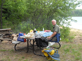
| Unloading at the site #702 |
Day 2 – Tuesday, July 03, 2012
Day 3 - Wednesday, July 04, 2012
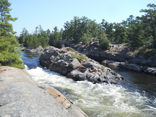
After some hesitations we decided to go to the Liley Chutes
and use the portage there – the way recommended by many people and by boaters
we met just above the Chutes. Portage was about 100 m long and went along the
open rocks. We took the pictures of the Liley Chutes from above – even with
this low water it would be impossible to pass them neither in kayak nor in
canoe. We were in the West Cross Channel now – just in place where we supposed
to come through the Old Voyageur Channel. Detour was finished thus and we
continued our route to the East through the Devil's Doors. Thise rapids are easily
accessible in the low water. “Behind the Doors” one has a choice: to go South
to the open waters of the Georgian Bay or to pass the treacherous labyrinth of
the West Cross Channel. The wind was fresh enough to persuade us to the latter.
If we’d know in advance that it will be 5(!) beaver dams to lift over instead
of 2 mentioned in Kevin Callan’s description, we’d better go to the Georgian
Bay.
It was still lunch time when we enter the East Cross Channel
and stopped for snack at the campsite #729. Paddling to the East we had to lift
over 5 beaver dams and the closer we were to the entrance into Georgian Bay the
louder the wind swept among the trees.
Day 4 – Thursday, July 05, 2012
Wind changed direction last night and once again in the
morning and became though not 100% fair but quite propitious for us to go along
the Georgian bay shore to the Bay which ended with the longest and most
comfortable portage in the area. It goes from Georgian Bay to the Bass Lake, is
240 m long and all covered by the plank. There is even a car to carry your
kayak/canoe and gear. Of course true travelers never used the car. We used it
for one trip and then abandoned and brought our canoe by ourselves.
When in the Bass Lake one has to hug the left shore not to
miss the channel heading to the North and hided behind an island. We had a nice
lunch and swimming session after
entering the main Channel of the French River and then paddled to the
North toward the “Elbow Cross”.
Day 5 – Friday, July 06, 2012
We’re heading home and there was a rare opportunity: the
favorable wind – just in our back. After crossing the Main Channel we formally
close the ring (circle) and entered into Wanapitei Bay again. Stopped for lunch
on the opposite side of the island where campsite #601 was situated (it was
occupied). Swam for the last time, boiled the water for tea on the gas stove
(tried it for the first time) and were ready to cover the last portion of our
route through the Hartley Bay to the Marina. It was Friday and more and more
boats run toward us in the opposite direction. It was just time to go home.
Again the wind was favorable and Olga even made a sale to speed canoe past my
kayak.
 |
| Americans in canoe: paddling with the kayak paddle and using sail |
At the Marina we met the team who began the trip same day as
we did and who portaged at the Bass Lake together with us. Took pictures of one
another and drove home.
 |
Our team. Hartley Bay Marina.
The Loop is closed! |
At 6:00 PM we were in Caledon. The Big French River Delta
Loop was closed successfully! My old dream came true!


